- La Feria Community Holds Succesful Business Mixer Event
- Little Nashville to Take Place in Downtown Mercedes
- Lions Basketball Captures District Gold
- La Feria ISD Students Compete in Regional Chess Tournament
- Lions End First Half of 32-4A on a High Note
- La Feria ISD Held Another Successful Parent Conference
- Strong Appearance for Lions at Hidalgo Power Meet
- LFECHS Students Get to Meet Local Actress
- Students Participate in Marine Biology Camp
- Two LFECHS Students Qualify for All-State Band
Oil-Rig Map Identifies Pollution Risks to Texas Children
- Updated: October 27, 2017

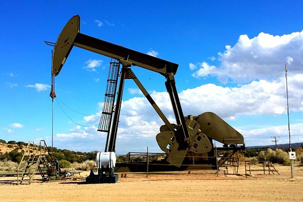
The latest Oil and Gas Threat Map identifies schools and child-care facilities located near oil and gas production operations. Photo: Pixabay
by Mark Richardson
SAN ANTONIO – As the Environmental Protection Agency backs away from limiting toxic emissions from oil and gas wells, Texas environmental groups are stepping up calls to limit the pollution. Earthworks and Moms Clean Air Force have released an updated version of their interactive Oil and Gas Threat Map, which identifies areas at risk from emissions from oil and gas production.
Krystal Henagan, Texas field consultant for Moms Clean Air Force, said the map reveals potential danger to schools and child-care centers near rigs that can emit methane, volatile organic compounds and other pollutants.
“In Texas, 782,627 children attend schools in a half-mile of active oil and gas facilities,” she said. “Oil and gas production threatens more school children in Texas than in any other state.”
Henagan said EPA Administrator Scott Pruitt is working to roll back Obama-era rules that reduce methane emissions, although the effort currently is tied up in the courts. She said these types of pollution put kids at risk for cancer, respiratory illness, birth defects, blood disorders and neurological problems.
When it comes to toxic emissions, said Alan Septoff, Earthworks’ strategic communications director, Texans aren’t getting much support from their elected officials either.
“Texas has removed municipalities’ power to address this pollution on their own, and Texas state government has shown no interest in doing so,” he said. “So, EPA is really the only game in town.”
Adelita Cantu, an associate professor of public health at the University of Texas Health Science Center, said emissions from oil and gas facilities pose a major public health risk for vulnerable populations.
“The most vulnerable among them within that half-mile radius are the most heavily impacted,” she said. “The air pollution that is emitted at different stages of the oil and gas operations can be harmful to children and older adults.”
The new version of the Oil and Gas Threat Map identifies more than 400,000 active oil and gas wells in the state, as well as the at-risk populations living within a half-mile threat zone around each facility.
The Oil and Gas Threat Map 2.0 is online at oilandgasthreatmap.com.


