
- Book Signing at Bailey H. Dunlap Library
- Young Author Selene Olguin Continues Local Book Tour
- La Feria Community Holds Succesful Business Mixer Event
- Little Nashville to Take Place in Downtown Mercedes
- Lions Basketball Captures District Gold
- La Feria ISD Students Compete in Regional Chess Tournament
- Lions End First Half of 32-4A on a High Note
- La Feria ISD Held Another Successful Parent Conference
- Strong Appearance for Lions at Hidalgo Power Meet
- LFECHS Students Get to Meet Local Actress
Harvey is History
- Updated: September 8, 2017
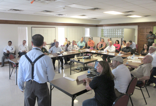
Barry Goldsmith, Warning Coordination Meteorologist, NWS speaks at USIBWC Public Forum.
All Eyes Now on September
Bill Keltner
The message from the National Weather Service is that now is not the time to drop your guard. Cat 4 Hurricane Harvey did historic, catastrophic damage to the Texas coast—we missed the bullet this time. But, beware—the hurricane season runs until November, and September is the historic peak of tropical storm activity in the Gulf of Mexico. So, don’t relax until the tropical storm threat ends. That was the message at a Hurricane preparation news media seminar sponsored by the National Weather Service/NOAA.
At the press conference, guest speaker, Barry Goldsmith, minced no words when he spoke to his rapt audience during the public forum sponsored by the U.S. International Boundary and Water Commission in Mercedes. His message was: what have we learned from a disastrous hurricane that struck the Valley in 1967, and is the Valley ready 50 years later?
Goldsmith is the Warning Coordination Meteorologist based at the National Weather Service in Brownsville. He told his audience that the National Oceanic and Atmospheric
Administration (NOAA) has updated how they see the 2017 hurricane season. The 45% prediction in May of this year has been increased to a 60% chance of an above-normal tropical storm season. The official forecast through November now predicts a chance of 14 to 19 named storms with the possibility of 5 to 6 turning into hurricanes, and perhaps two to five of those will be potentially major hurricanes.
“It looks like a more active September through the end of the season in November,” he said: “Question now–are we in better shape should one of them make landfall in or near the Rio Grande Valley?”
Hurricane Beulah occurred 50 years ago. Goldsmith said that we have learned a lot since then. Communications are better, levees and floodways have been improved, and our forecasting is so much better now. “But,” he said, “The Valley has grown and expanded. The population and housing construction has greatly increased since 1967, and many could be living in flood-prone zones–and not be aware of it.”
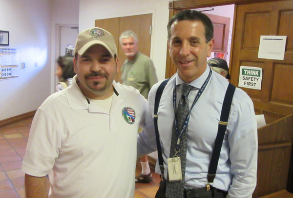
Juan Uribe, Area Operations Manager, USIBWC, Barry Goldsmith, Warning Coordination Meteorologist, National Weather Service.
Winds during Hurricane Beulah came ashore on South Padre Island with a velocity of 136 miles per hour. Wind damage was widespread; storm tides reached 8-10 feet; the storm spawned 115-140 reported tornados. The total damage state-wide from that one storm was reported to be $1billion. (The total damage from Hurricane Harvey will be Staggering)
To put it in perspective, he said, “90% of construction in the United States can not withstand 125 mph winds. It is probably worse in the Valley, now with 1500 “colonias” with poor construction on loamy soil in flood-prone, low-lying parts of the Valley. We would become ’Lake Rio Grande Valley ” He added: “a 25 foot storm surge on the coast would put Brownsville under 5 feet of water. We call ourselves a ‘Valley’, but, in reality we are a delta. Deltas are known for flooding.”
On the positive side, he added, “Today, we have evacuation shelters in many parts of the Valley; better evacuation routes if needed, and stronger building codes have been required on all recent construction–all that is to the good.”
As to the bottom line–is it too late? “It is never too late to prepare,” he said, “remember, 2017 started out with a ‘Jack Rabbit” start and quickly calmed down, ; But September 10 is the peak of the hurricane season each year. September is always a ’wild card”–don’t let your guard down. Remember Beulah was only the second storm of the 1967 tropical storm season–and, it only takes one to mark a memorable hurricane season! Goldsmith welcomes calls for information about the hurricane preparedness at 956 572 1492 or visit weather.gov/rgv.
The Lower Rio Grande Flood Control Project has improved, but has urban drainage kept up with population growth? Is today’s building stock able to handle hurricane-force winds?
Those questions will be answered after the next unwelcome visitor from the Gulf of Mexico makes landfall on the South Texas coast.